Free Download ESRI ArcGIS Pro 3.1.5 Build 185013 with Content | 13.7 Gb
Languages Supported: English, العربية, 汉语, 漢語, Čeština, Suomi, Français, Deutsch, Italiano,
עִבְרִים, Italiano, 日本語, 한국어, Polski, Português (Brazilian),
Русский, Español, Svenska, Türkçe
Esri, the global leader in spatial analytics technology, is pleased to announce the availability ofArcGIS Pro 3.1.5. Base release is filled with a host of productivity and performance improvements to keep you mapping, editing, analyzing, managing, and sharing.
Owner:Esri
Product Name:ArcGIS Pro
Version:3.1.5 (185013) with Content *
Supported Architectures:x64
Website Home Page :
Mã:
http://www.esri.com
Languages Supported:multilanguage
System Requirements:Windows **
Size:13.7 Gb
What's New in ArcGIS Pro 3.1
Many new features have been added to this release, including catalog datasets, automatic resizing and repositioning of layout elements, time-enabled scene layers, scale-based label sizing, a magnifier window, and a new extension, ArcGIS Reality for ArcGIS Pro.
This video highlights the top ten new features in the ArcGIS Pro 3.1 release. To see all the new and improved functionality in this release, go to What's new in ArcGIS Pro in the ArcGIS Pro help.
ArcGIS Pro 3.1.5 fixes the issues listed below and includes the fixes listed in the subsequent sections for ArcGIS Pro 3.1.0, 3.1.1, 3.1.2, 3.1.3, and 3.1.4.
BUG-000139285 In a utility network, the domain codes are displayed instead of the descriptions after modifying associations with the display field set to asset type.
BUG-000147443 Improve the Trim Archive History geoprocessing tool to filter out duplicate trim attempts.
BUG-000152055 Unable to see differences in the Differences view when the layer has a join in ArcGIS Pro.
BUG-000152404 Unable to copy and paste the utility network or parcel fabric from an SQL Server enterprise geodatabase to a file geodatabase due to an attribute rule evaluation failure.
BUG-000154971 In ArcGIS Pro, after editing a feature service referencing registered data from a PostgreSQL geodatabase for the first time, a dirty area is not displayed.
BUG-000155010 The STArea() field displays different values based on the table view mode (for example, the Show All Records versus Show Selected Records mode).
BUG-000159073 Map.ChangeVersion() fails to change the version of the second map when using a branch versioned feature layer in ArcGIS Pro SDK for .NET 2.9.x and 3.1.x.
BUG-000159921 With a feature class without a coordinate system, ArcGIS Pro crashes when clicking Ready to Use Rules (Attribute Rules).
BUG-000160488 The ArcGIS Pro Locate tool executes a redundant select count(*) query before performing an actual search.
BUG-000161491 The warning message, "WARNING 002547: Layer doesn't participate in the utility network", is returned when creating a network diagram on a utility network layer participating in a join with a non-utility network table.
BUG-000161682 An unknown error is returned when changing HistoricalVersion using DateTime in ArcGIS Pro SDK for .NET.
BUG-000162095 In ArcGIS Pro, the attempt to modify terminal connections with a duplicated layer on the map returns the error message, "No Valid line feature has been selected."
BUG-000162360 Performing an isolation trace with a directional device near an isolated section returns incorrect trace results.
BUG-000162567 Creating routes causes ArcGIS Pro to crash.
BUG-000162775 The query builder must not create queries to fetch distinct values when a field is selected.
BUG-000162973 Remove the option to recompile from branch versioned query statements.
BUG-000163037 The Generate Intersections tool takes an exceptionally long time to run on two routes.
BUG-000163124 The median values for an even number of records are incorrect when calculated using data engineering.
BUG-000163163 When a calibration point is added to the end of the route with the same measure and a different date, the calibrate event behaviors do not time slice the impacted point events.
BUG-000163346 Copying a utility network between enterprise geodatabases fails when duplicate indexes are encountered.
BUG-000164293 The ArcGIS Pro Workflow Manager extension displays the message, "Unable to connect," if the request response takes more than 12 seconds to process.
BUG-000164583 While debugging an ArcGIS Pro SDK for .NET add-in, evaluating certain properties in the watch window fails with a "Cannot evaluate expression because the thread is in a stack overflow state" message.
Esri ArcGISis a geographic information system (GIS) software platform. GIS is used primarily to analyze spatial and locational data. The Esri ArcGIS platform offers both traditional desktop applications as well as cloud based tools.
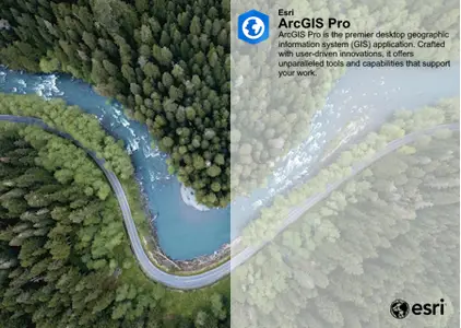
ArcGIS Pro, the powerful single desktop GIS application, is a feature-packed software developed with enhancements and ideas from the ArcGIS Pro user community. ArcGIS Pro supports data visualization; advanced analysis; and authoritative data maintenance in 2D, 3D, and 4D. It supports data sharing across a suite of ArcGIS products such as ArcGIS Online and ArcGIS Enterprise, and enables users to work across the ArcGIS system through Web GIS.
ArcGIS Pro: The World's Leading GIS Software
ArcGIS Pro, the powerful single desktop GIS application, is a feature-packed software developed with enhancements and ideas from the ArcGIS Pro user community. ArcGIS Pro supports data visualization; advanced analysis; and authoritative data maintenance in 2D, 3D, and 4D. It supports data sharing across a suite of ArcGIS products such as ArcGIS Online and ArcGIS Enterprise, and enables users to work across the ArcGIS system through Web GIS.
Esri, the global market leader in geographic information system (GIS) software, location intelligence, and mapping, helps customers unlock the full potential of data to improve operational and business results. Founded in 1969 in Redlands, California, USA, Esri software is deployed in hundreds of thousands of organizations globally, including Fortune 500 companies, government agencies, nonprofit institutions, and universities. Esri has regional offices, international distributors, and partners providing local support in over 100 countries on six continents. With its pioneering commitment to geospatial technology and analytics, Esri engineers the most innovative solutions that leverage a geographic approach to solving some of the world's most complex problems by placing them in the crucial context of location.
ArcGIS_License_Manager_Windows_2022_1_184717
ArcGIS_Workflow_Manager_Classic_Admin_for_Pro_31_185026
ArcGISPro_31_184994
ArcGISPro_31_Data_Interop_Ext_185025
ArcGISProHelp_31_185018
ArcGIS_Coordinate_Systems_Data_Windows_111_185041
ArcGIS_Raster_Data_Windows_111_185042
ArcGISPro_31_PerUser_Coordinate_Systems_Data_184980
ArcGISProAviationAirportsProductData_31_185043
ArcGISProAviationChartingProductData_31_185044
ArcGISProDefenseMappingProductData_31_185045
ArcGISProIndoorsProductData_31_185046
ArcGISProMaritimeProductData_31_185047
ArcGISProProductionMappingProductData_31_185048
IBM_DataServerRuntimeClient_111FP5_185724
Microsoft_ODBC_Driver_17_SQL_Server_64bit_185619
Microsoft_ODBC_Driver_18_SQL_Server_64bit_185620
Microsoft_ODBC_Driver_131_SQL_Server_64bit_167177
OracleDatabaseInstantClient_19c_182148
OracleDatabaseInstantClient_21c_182149
PostgreSQL_DBMS_for_Windows_139_185703
PostgreSQL_DBMS_for_Windows_146_185704
PostgreSQL_DBMS_for_Windows_1118_185701
PostgreSQL_DBMS_for_Windows_1213_185702
IBM_DataServerRuntimeClient_111FP5_185725.tar.gz
OracleDatabaseInstantClient_19c_182150.tar.gz
OracleDatabaseInstantClient_21c_182151.tar.gz
ArcGISPro_31_ST_Geometry_Oracle_185049.zip
ArcGISPro_31_ST_Geometry_PostgreSQL_185050.zip
ArcGISPro_31_ST_Geometry_SQLite_185051.zip
ArcGISProSDK_31_185052.exe
ArcGISProLP_31_ar_185053.exe
ArcGISProLP_31_cs_185056.exe
ArcGISProLP_31_de_185059.exe
ArcGISProLP_31_es_185067.exe
ArcGISProLP_31_fi_185057.exe
ArcGISProLP_31_fr_185058.exe
ArcGISProLP_31_he_185060.exe
ArcGISProLP_31_it_185061.exe
ArcGISProLP_31_ja_185062.exe
ArcGISProLP_31_ko_185063.exe
ArcGISProLP_31_pl_185064.exe
ArcGISProLP_31_pt_BR_185065.exe
ArcGISProLP_31_ru_185066.exe
ArcGISProLP_31_sv_185068.exe
ArcGISProLP_31_tr_185069.exe
ArcGISProLP_31_uk_185070.exe
ArcGISProLP_31_zh_CN_185054.exe
ArcGISProLP_31_zh_TW_185055.exe
ArcGIS_Pro_311_185017.msp
ArcGIS_Pro_312_185016.msp
ArcGIS_Pro_313_185015.msp
ArcGIS_Pro_314_185014.msp
ArcGIS_Pro_315_185013.msp
Recommend Download Link Hight Speed | Please Say Thanks Keep Topic Live
Trích dẫn:
Rapidgator
http://peeplink.in/faa8ad470a5a
Uploadgig
bxbwc..SETUP.part1.rar
bxbwc..SETUP.part2.rar
bxbwc..SETUP.part3.rar
bxbwc..SETUP.part4.rar
Fikper
bxbwc..SETUP.part1.rar.html
bxbwc..SETUP.part2.rar.html
bxbwc..SETUP.part3.rar.html
bxbwc..SETUP.part4.rar.html
http://peeplink.in/faa8ad470a5a
Uploadgig
bxbwc..SETUP.part1.rar
bxbwc..SETUP.part2.rar
bxbwc..SETUP.part3.rar
bxbwc..SETUP.part4.rar
Fikper
bxbwc..SETUP.part1.rar.html
bxbwc..SETUP.part2.rar.html
bxbwc..SETUP.part3.rar.html
bxbwc..SETUP.part4.rar.html
No Password - Links are Interchangeable